The United Kingdom Prepares for Winter’s Assault
Following a period of unpredictable weather, the United Kingdom is bracing for a harsh meteorological shift. The winter, until now moderate, seems set to make its presence felt forcefully. The latest weather forecasts, based on updated models, predict a dramatic drop in temperatures that could plummet to -2°C in some areas within just over a week. However, the most striking element is undoubtedly the extent of this cold snap: snowfall is now anticipated in areas typically considered milder, particularly in the south of the country, such as Devon.
This prospect of a rigorous winter, which contrasts sharply with the seasonal average, raises legitimate concerns about the impact of this intense cold on transportation, energy consumption, and daily life. How can we explain this influx of icy air? Which regions are most likely to be affected by snow and freezing conditions? And what are the experts, including the Met Office, saying about the duration of this episode? Let’s analyze the maps and forecasts to understand the dynamics of this Arctic cold wave sweeping across the British Isles.
I. Analyzing the Weather Maps: A Rapidly Settling Cold
Recent weather models, particularly those visualized on charts like WXCHARTS (using MetDesk data), confirm the arrival of a much colder air mass, indicating a drastic temperature drop and winter precipitation.
A. The Plunging Temperatures: A Significant Departure from the Norm
The key date highlighted by forecasts is December 6th. From this date, just over a week away, conditions are set to become considerably tougher.
- The Cold Peak: Temperatures are expected to plummet, reaching -2°C in the most exposed areas, notably the Scottish Highlands and the Scottish Borders. It is crucial to note that this temperature is well below the UK’s average for December, which usually hovers around +6°C. This 8-degree differential signals an exceptional cold spell requiring heightened preparation.
- Northern England Affected: While mainland England is predicted to be “slightly milder,” with temperatures mostly ranging between 3°C and 4°C, certain northern regions, such as Cumbria, could also experience a sharp freeze, with forecasts reaching -1°C. The North is typically more accustomed to these conditions, but persistent frost can lead to serious problems.
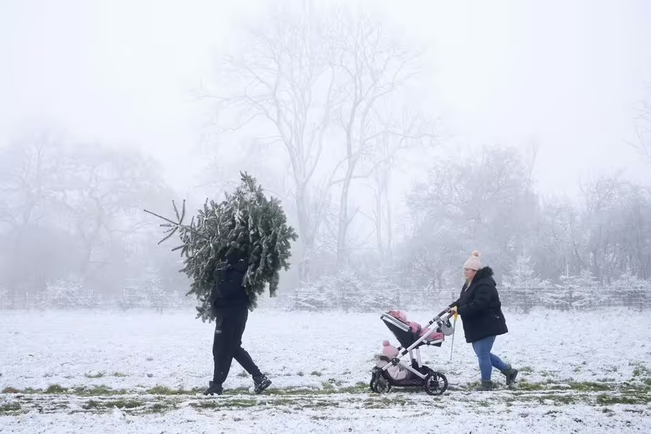
B. The Extent of Snowfall: Arctic Air Reaches the South
The most surprising element of this forecast is the geography of the snowfall. It will not be limited to the usual mountainous or northern areas.
- Snow in the South West: Snow is clearly forecast as far south as Devon, in South West England. Devon, with its southern coast and generally milder, more oceanic climate, is rarely affected by significant snowfall, especially on this scale. Such a forecast indicates the depth and breadth of the cold air mass that is about to settle.
- Regions Concerned: Other UK regions are also under watch for snowfall on the evening of Sunday, December 6th (around 6 PM). This includes, less surprisingly, the Scottish Highlands and North Wales, but also more central and eastern regions such as Warwickshire and Norfolk.
II. Understanding the Meteorological Dynamics: An Atmospheric Flow Favouring Cold
For an Arctic air mass to descend this far south into Western Europe, a specific atmospheric configuration is required.
A. The Role of Low-Pressure Systems
According to the Met Office (the UK’s national weather service), the period from December 2nd to 11th is expected to be marked by “changeable and often unsettled conditions.”
- Low-Pressure Dominance: Low-pressure systems (depressions) are expected to dominate. Typically, depressions bring rain and sometimes strong winds. However, when they interact with a very cold air mass accumulated further north, they can lead to precipitation in the form of snow.
- Varied Precipitation: The Met Office forecasts “showers or longer spells of rain for much of the UK,” but notes that some “brief drier, more settled interludes are also possible.” It is within this mix that cold air can seep in and turn rain into snow, particularly over higher ground and where moisture is highest.
B. The Arctic Influence and the Greenland High (Simplified Explanation)
While the raw article is very brief, a pedagogical context can be added to explain the origin of the cold. The arrival of “Arctic” cold in the UK is often linked to a phenomenon called “blocking.”
- The Blocking Phenomenon: Usually, the jet stream (a fast, powerful current of air flowing west to east) steers Atlantic low-pressure systems toward the UK, bringing mild, wet conditions. When the Greenland High (a stable, cold high-pressure area) strengthens and positions itself to the north-west, it can “block” the jet stream.
- Opening the “Cold Portal”: This blocking forces the jet stream to dive south, creating an air flow pattern that allows cold air masses coming directly from the Arctic or North-Eastern Europe to descend unimpeded over the UK. This is the configuration that enables temperatures of -2°C to reach the south of the country.
III. Practical Consequences and Preparation Measures
The anticipation of a cold snap and snowfall across an area as wide as the UK necessitates logistical and individual preparation.
A. Impact on Transport and Infrastructure
Snow, even in small amounts, can paralyze infrastructure, especially in areas unaccustomed to it like Devon or Warwickshire.
- Roads and Railways: Transport services (motorways, railways) are preparing for potential delays due to snow and ice (which forms when rain freezes on contact with a surface below 0°C). Local authorities typically begin stocking up on road salt and organizing response teams.
- Air Travel Disruption: Airports are also likely to experience delays or cancellations if snowfall is heavy or if ice disrupts ground operations.
B. Preparation Advice for the Public
Experts emphasize the importance of preparation in the face of extreme winter conditions.
- Home Checks: Residents are advised to check home insulation, protect external pipes from freezing, and ensure heating systems are working correctly, particularly in areas expecting sub-zero temperatures, such as Cumbria and Scotland.
- Road Safety: For those who must travel, checking tires, antifreeze levels, and packing an emergency kit (blanket, water, jump leads) becomes essential, especially in remote areas.
A Crucial Week for the British Winter
The imminent arrival of an intense cold snap and the prospect of snowfall reaching as far south as Devon mark the beginning of a potentially tougher-than-average winter for the UK. Weather maps clearly indicate that Arctic air, capable of dropping mercury to -2°C, is on its way.
This situation, while predictable, demands caution and collective preparation. The contrast between the severe cold in Scotland and the rare sight of snow on the hills of the South West is a testament to the power of this atmospheric dynamic. The coming days will be crucial for refining these forecasts, but the message is clear: the UK must prepare to pull out its warmest clothes and snow shovels. What measures are you taking to cope with this sudden drop in temperatures?